$10.00
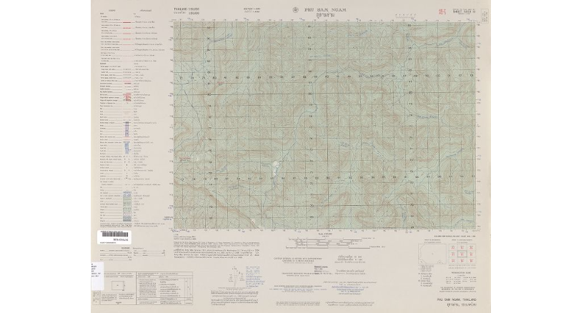
Explore history with the US Military 1:50,000 Scale Map of Phu Ngam, Thailand, dated 1956. Featuring detailed contours and spot heights, this vintage collectible offers a unique glimpse into mid-20th-century cartography. Perfect for collectors and survival enthusiasts alike.
Discover a Piece of History with the US Military 1:50,000 Scale Map of Phu Ngam, Thailand – Sheet 5453 IV, Dated 1956
This authentic vintage map offers a detailed glimpse into the geographical and strategic landscape of Phu Ngam, Thailand, as documented by the US Military in 1956. Ideal for collectors, history enthusiasts, or survivalists, this map is a valuable addition to any collection.
This map serves as a remarkable artifact from the mid-20th century, reflecting the meticulous cartographic practices of the US Military. The contours and spot heights provide a comprehensive view of the terrain, making it not only a collector’s item but also a practical tool for understanding the geography of the region during that period. The map’s precision and detail are ideal for those interested in historical geography, military history, or vintage cartography.
Compatibility and Use: This map is perfect for collectors of vintage military memorabilia, educators in historical geography, and survivalists seeking to enhance their understanding of historical terrains. Please note that the photo provided is an example and not the actual map.
| Weight | 2 lbs |
|---|---|
| Dimensions | 24 × 2 × 2 in |